When in 2022 Affinity Water announced their plans to restore two sections of the River Misbourne in Old Amersham, the Society agreed to develop a project to build on proposed improvements by explaining the nature of chalk streams, their geology and ecology, their use and misuse over time and the history of the river in Amersham.
After the restoration works were completed in 2023, the Committee formed a working group to launch the project. As well as the Dulcie Denison legacy, they obtained additional support from Amersham Town Council and local residents Brian Withington and Graham Cook for which we are grateful.
The first stage of the project, the installation of an information panel at Church Mead and the development of this web page to provide some additional information, was completed in Jul 2024. The second stage, the installation of an information panel near the river on Barn Meadow, and the third, the developing a riverside walk along the Misbourne in Amersham, were accomplished in Dec 2024.
- About the Misbourne;
- Church Mead Information Panel;
- Barn Meadow Information Panel;
- Amersham Riverside Walk.
About the Misbourne
The Misbourne is a chalk stream, it rises in Great Missenden and runs for about 27km (17 miles) until it joins the River Colne in Denham.
Chalk streams are rare. England has 283 chalk streams, about 85% of the world total. Chalk is a porous rock, which absorbs the rain, percolating down until it reaches the impermeable clays. It’s a slow process so much of the rain is held in a huge underground store, called an aquifer. Water slides out of the hillside, off the clay level and appears in springs of clear water at a steady temperature, having been through a giant chalk filter. With its calcium content, the stream water provides a natural habitat very suitable for certain types of plant and animal life.
Amersham grew up on the banks of the Misbourne because it provided a reliable supply of clear water for drinking by people and animals and our first information panel refers to bronze age finds in the river, shows the line of Roman roads and prehistoric trackways crossing the river. The river was gradually straightened and widened to support the many mills which grew up on the river making it much less suitable for wildlife.
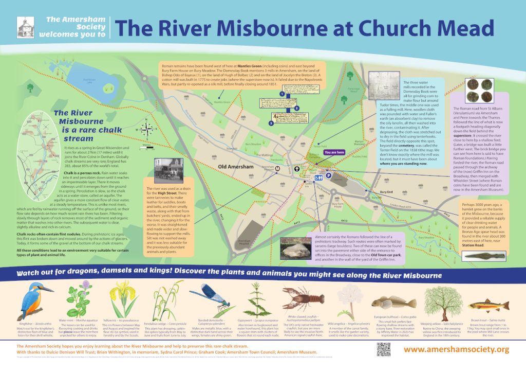
Church Mead Information Panel
To read information published on the panel please click on the image below (PDF 9 MB), for additional information please scroll down.
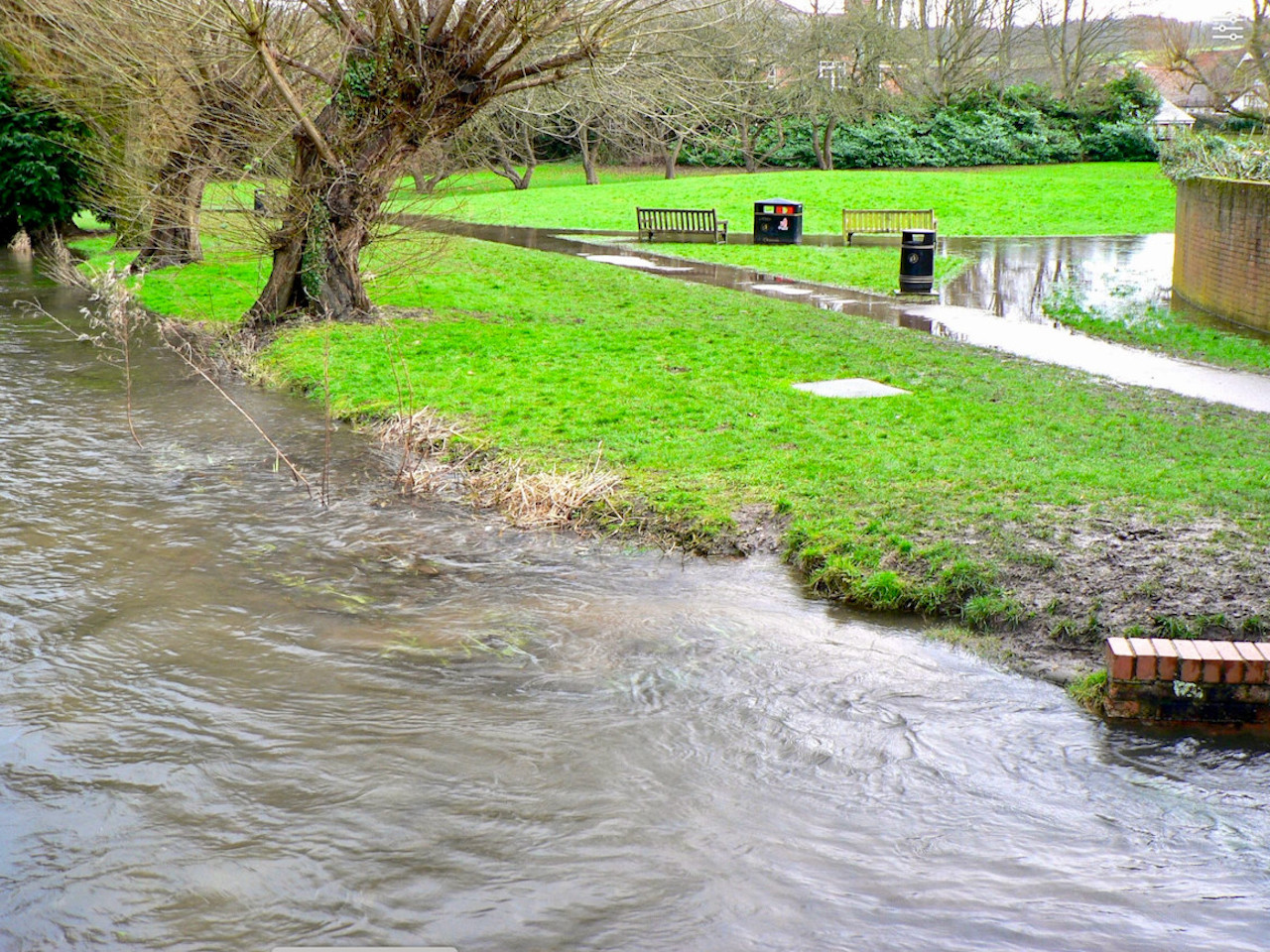
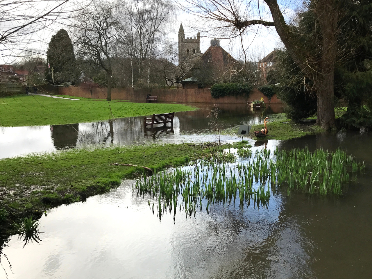
Floods at Church Mead
The River Misbourne over-topped its bank, flooding Church Mead for several weeks in both 2014 and 2024 (see photos).
However, flooding around here is nothing new.
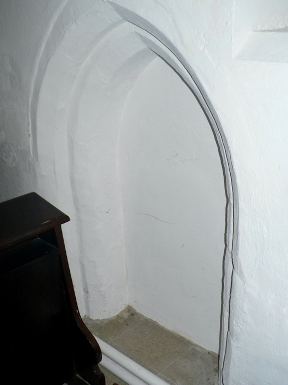
In the 15th century, the floor level of St Mary’s Church was raised by about 65cm because of repeated flooding.
If you go into the church via the porch on the south side, you can still see the evidence of this in the form of two low, blocked doorways, one immediately on your left as you enter the church, the other a little further round.
But even further left, if you were to go into the bell tower (it’s usually locked) you would you have to descend three steps before then climbing the stairs up the tower.
Roman remains were discovered near the eastern end of the Amersham by-pass when a pipeline was being constructed. Other remains have been found around Mantles Green Farm.
For example, Roman coins from Coldmoreham (the farmhouse and yard beyond 160 High Street) are now in the Amersham Museum as are coins found at the Friends Meeting House (Quakers) in Whielden Street.
There is said to be a Roman villa at the bottom of Shardeloes lake, and very likely the remains at Mantles Green were the farm associated with it.
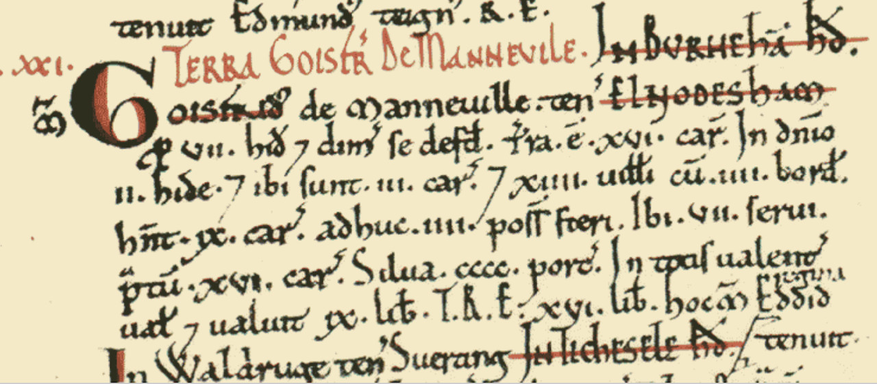
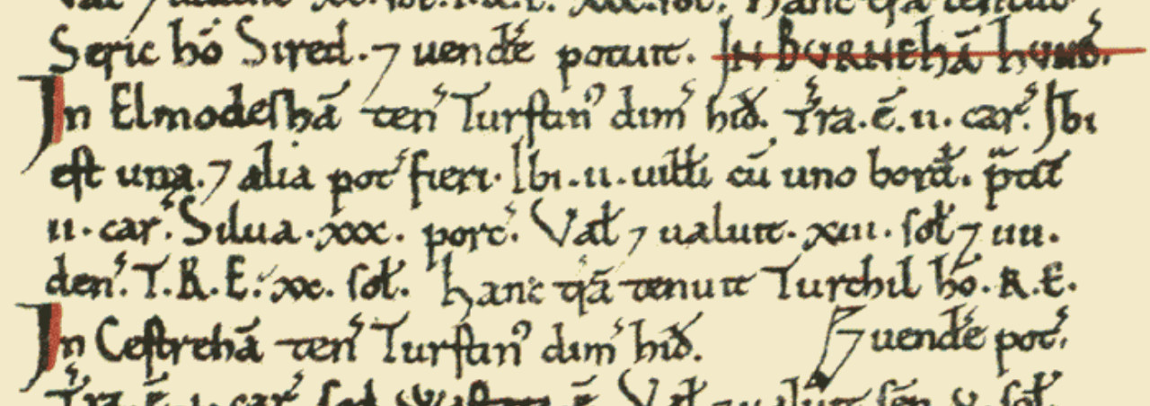
At the time of the Norman conquest in 1066, all the land in the parish of Elmodesham (Amersham) belonged to, or was under the protection of, Queen Edith, the widow of Edward the Confessor.
Even William the Conqueror felt he could not confiscate the lands of a queen so it was not until her death in 1075 that the six manors (estates) into which the parish was divided were re-allocated. We don’t know which manors were where.
However according to the Domesday Book (see Ref. 1), the main manor given to Geoffrey de Mandeville must correspond to the one based at Bury Farm and it’s reasonable to speculate that Thurston Mantle may have given his name to Mantles Green Farm (see Ref. 2).
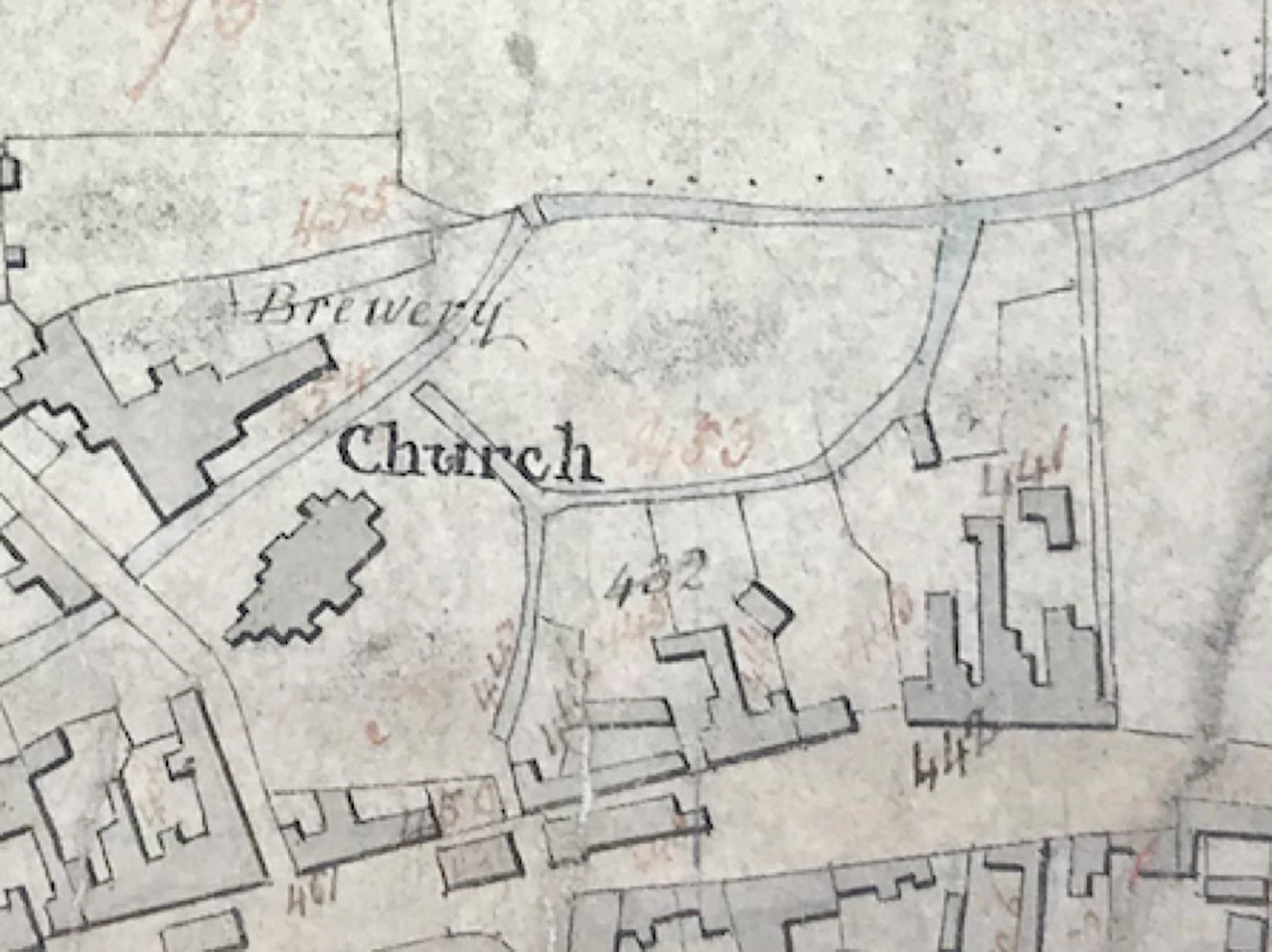
The Tithe Map of 1838 shows that at the time Church Mead (field 83) was almost entirely surrounded by water – the river on the north side and channels on the other sides, with a spur going alongside what are now the Memorial Gardens, almost to the Broadway.
These channels must be all that remains of the mill race for the mill, originally mentioned in the Domesday Book later used as a fulling mill.
The spur would have fed water to the Griffin Maltings, the white building (now a beautician).
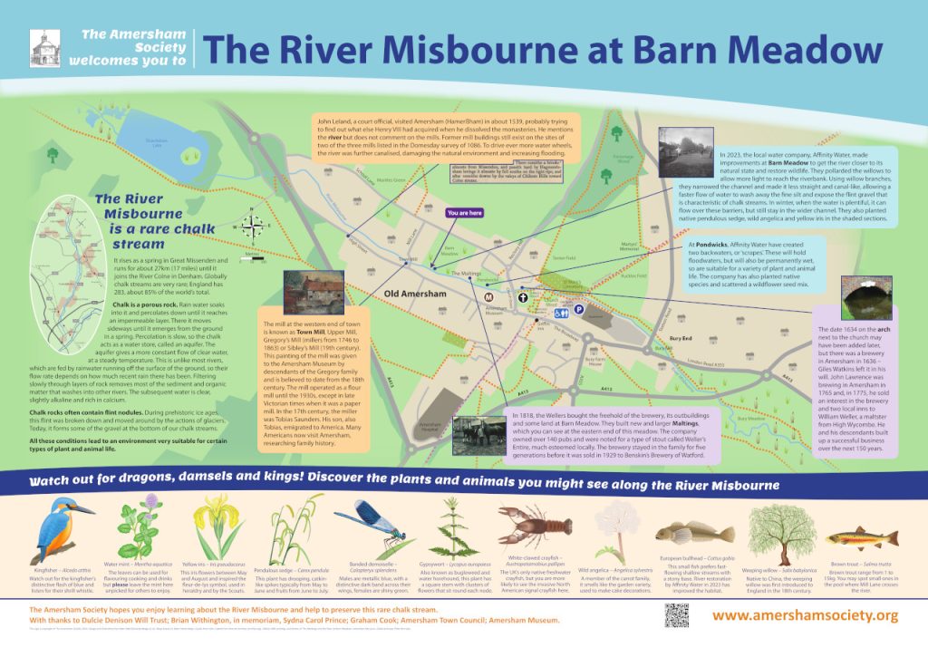
Barn Meadow Information Panel
To read information published on the panel please click on the image below (PDF 9 MB), for additional information please scroll down.
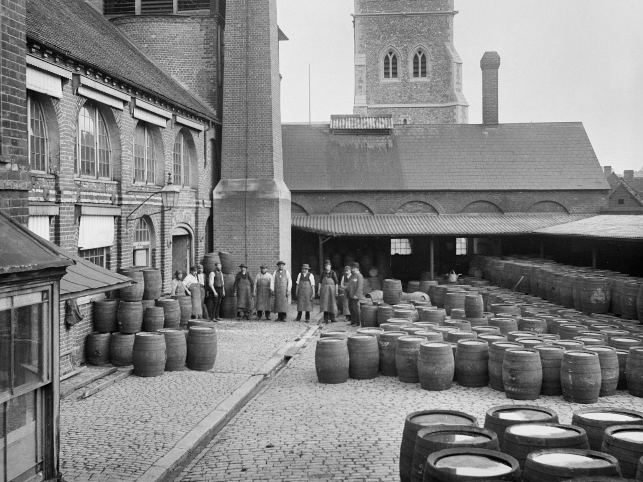
The Weller’s Brewery
In 1775 William Weller bought an interest in the existing brewery, based in what is now Badminton Court in Church Street and in 2 local pubs. Three of his sons (John, William II and Joseph) became brewers. One of John’s sons (Edward) and one of William II’s sons (William III) continued the family business. Three of William III’s sons (William IV, Edward II and George) became brewers but when George, the last of these, died in 1929, his son Gerard sold the business to Benskin’s Brewery of Watford. So ended over 150 years of brewing in Amersham by the Weller family.
The George Ward photo (courtesy of Amersham Museum) can be recognised as what is now a car park for Badminton Court. The yard on the opposite side of Church Street, where Amersham Town Council is now located, housed the drays and various offices. William III married the daughter of a wealthy brewer from Hemel Hempstead, Lydia Holloway, who added part of the Holloway Brewery to the Weller business, and they lived in houses to the north of the brewery on Church Street. The large garden was perfect for their 11 children!
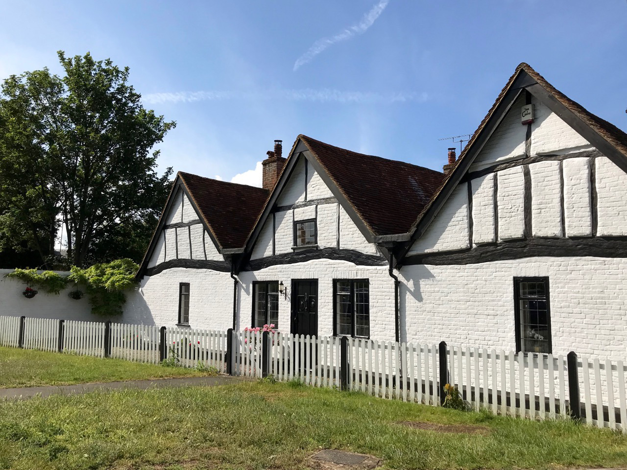
The Three Gables house on the corner of Church Street and Rectory Way, probably originally the tithe barn, was used by the Weller’s Brewery as a barrel store.
Restoring the river
In the 1980’s the Misbourne was listed in the top 20 UK rivers most affected by abstraction. In 1998 a low flow alleviation scheme was implemented, reducing abstraction from pumping stations in the Amersham area by nearly 50%. This scheme has helped to increase flows above Amersham. A second phase of work was undertaken to improve flow in the middle part of the river. In 2023, Affinity Water carried out the following improvements on Barn Meadow:
- Completed tree works to allow more natural light into the river channel, encouraging vegetation to grow on the banks and the riverbed.
- Created earth berms (raised riverside terraces) to introduce small meanders to the channel, improving flow velocities – particularly in low flow conditions.
- Used gravels that are characteristic of the catchment to augment the riverbed – creating gravel riffles for diversity of flow and to improve the habitat for fish and invertebrates, who use the gravels for spawning and feeding.
- Formed a gravel ‘beach’ to provide a safe access point, as well as reducing bank erosion.
- Regraded the riverbed as the ‘steepness’ of rivers drives important processes such as erosion, sediment movement and flow speed.
Crayfish
The White-clawed Crayfish (Austropotamobius pallipes) is the only native fresh-water crayfish found in the UK.
It is bronze-coloured crustacean with pale undersides to its claws – hence the name. It’s about 6-12cm long, can weigh up to 90g and usually lives 8 to 12 years. It is a protected species in the UK under the Wildlife and Countryside Act, 1981 and is listed as Endangered on the global IUCN Red List of Threatened Species.
However, you are much more likely to spot the invasive North American Signal Crayfish (Pacifastacus leniusculus) here. It has a darker, stockier body, larger claw, with a white/blue spot on them. Overall, it’s larger too. Their population has been thriving since they were brought to England as a fashionable seafood. It carries a fungal disease called ‘crayfish plague’, which is harmful to our native species, and can be spread by wet footwear and equipment. It remains to be seen whether the various improvements undertaken by Affinity Water and others lead to the reappearance of the white-clawed crayfish here.

The Saunders families of Amersham
The Saunders family were probably the richest family in Amersham for about 180 years, straddling the Tudor period. In about 1450, William Saunders rented The Bury, the manor house for the Borough of Amersham, from the Lord of the Manor, originally the Duke of Buckingham, later the king. In 1586 they paid a rent of 84 bushels of malt. A bushel was measure of dry volume, equivalent to about 1830 kg of barley – you can brew a lot beer with that.
In the reign of Henry VIII, the family were prominent Lollard supporters, religious dissenters who believed, amongst things, that people should be free to read the Bible in English or say their prayers in English, whereas the Church and State required them to do so in Latin. Richard Saunders, son of William Saunders, the head of the family at the time, was condemned as a heretic and required to wear a Lollard badge on his sleeve. Instead, he carried it in his purse and was fined £20, which was a great deal of money in the early 16th century. Because of this many Americans would like to claim descent from the family.
Tobias Saunders, miller, made his will in 1642, although we don’t know which mill he operated. Tobias’s son, also Tobias, emigrated to America and many Americans claim descent from him. However, it is not at all clear that Tobias Saunders, the miller, was a descendant of William or Richard Saunders. The parish registers, admittedly incomplete for that period, do not show a direct relationship. However, the registers do show that on 30th May 1596 Tobias Saunders, son of Richard Saunders, and Elizabeth Saunders, daughter of a ‘Mister’ Saunders, were both baptised. The use of the respectful ‘Mister’ shows that he was one of the prosperous residents of The Bury. Was baptism of two Saunders babies on the same date coincidence or evidence of a family event? If Tobias Saunders the miller was actually related to the wealthy Saunders family it seems more likely that he would be the miller at Bury Mill, at the eastern end of the town, near The Bury.